
HAS Regents Professor Vic Baker Talks About Megafloods on Geology Bites Podcast
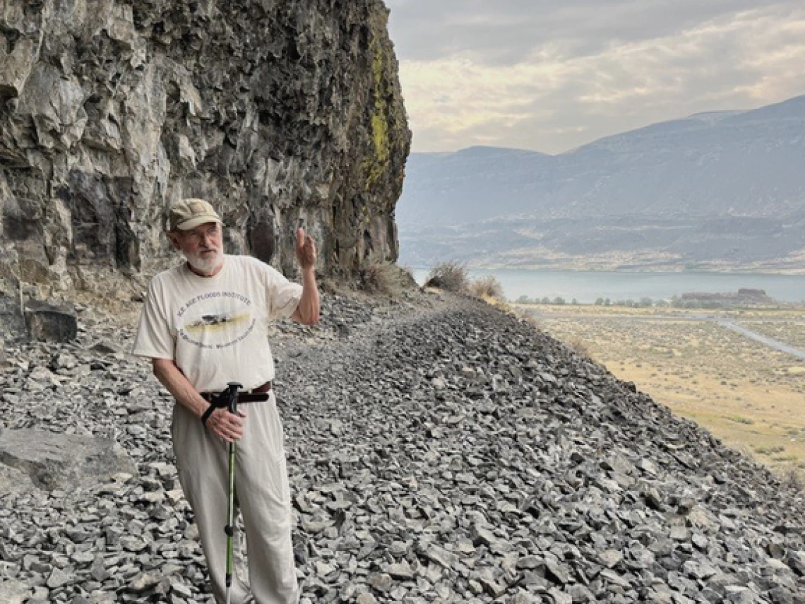
Image: Geology Bites Blog
Listen to the podcast, Vic Baker on Megafloods, here.
¤
Congratulations to HAS Regents Professor Vic Baker who was recently interviewed on the prestigious Geology Bites Podcast!
Geology Bites is a podcast blog that exists to have "conversations about geology with researchers making key contributions to our understanding of the Earth and the Solar System." The blog is well-known internationally and is highly esteemed by Cambridge University Press. Their primary questions are:
"What moves the continents, creates mountains, swallows up the sea floor, makes volcanoes erupt, triggers earthquakes, and imprints ancient climates into the rocks? Oliver Strimpel, a former astrophysicist and museum director, asks leading researchers to divulge what they have discovered and how they did it."
On April 13, Strimpel talked with HAS Regents Professor Vic Baker about megafloods.
Megafloods are cataclysmic floods that are qualitatively different from weather-related floods. In the podcast, Vic Baker explained our ideas as to what causes megafloods and described the striking evidence for such floods in the Channeled Scablands of Washington State and in the Mediterranean.
The sample of images below includes just four of 17 images used in the podcast to illustrate megafloods in the regions of Washington State, the Mediterranean basin, the English Channel, and Mars.
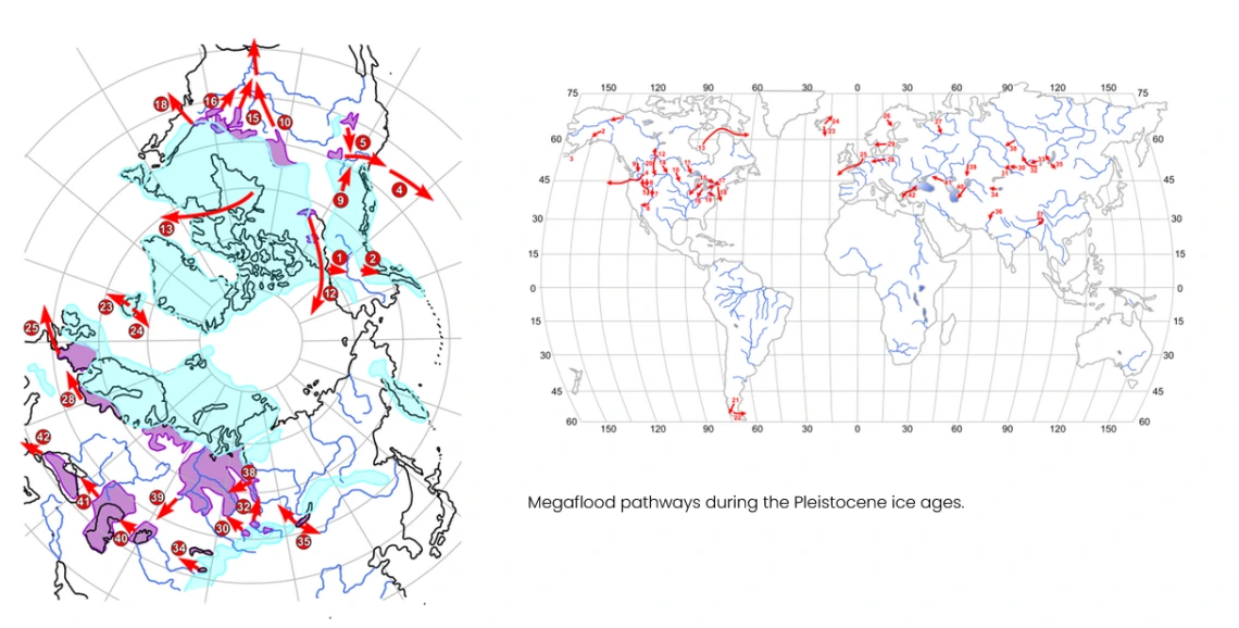
Image: Vic Baker
Megaflood pathways during the Pleistocene ice ages.
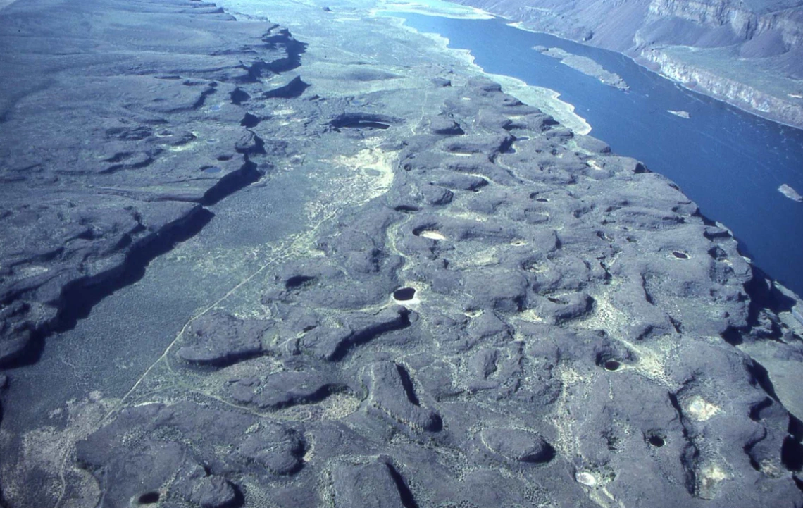
Image: Vic Baker
Rock basins eroded into Columbia River Basalt at Lenore canyon, Lower Grand Coulee in the Channeled Scabland of Eastern Washington. Note the roads for scale.
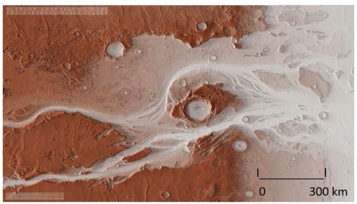
Image: Vic Baker
Map view and topography of the Kasei Vallis megaflood channel. Kasei Vallis is the largest of the Martian outflow channels, about 3,000 km long and up to as much as 400 km wide in the areas shown.
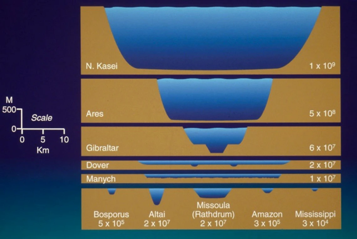
Image: Vic Baker
Relative sizes of flood channelways. The top two are Martian megaflood channels. The Manych spillway connected the ancient Caspian to what is now the Black Sea. The Altai was a megaflood landscape in central Asia. The numbers refer to the peak discharges in cubic meters per second. The vertical scale is greatly exaggerated.
Congratulations, Vic, for being recognized on this podcast and for your immense contributions to this field of study!
Geology Bites currently has 106 episodes, each about 30 minutes long. Use the index to browse by topic. If you’d like to be notified when a new episode comes out, you can set that up on the Contact page.
At the homepage, scroll down, select an episode, listen directly from the episode page, and view supporting material while you listen.
Or listen and subscribe wherever you get your podcasts, such as at Apple Podcasts, Spotify, or via the RSS feed.